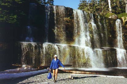
The West Coast Trail, Port Renfrew, B.C.
THE WEST COAST TRAIL
VANCOUVER ISLAND, BRITISH COLUMBIA
1 - 6 July 1996
TRAVELS WITH TOMMY
The West Coast Trail, Port Renfrew, B.C.
For more detailed maps of the West Coast trail, click here. These maps are quite detailed and printable
(maps courtesy of http://www.portrenfrew.com)
PREPARATION
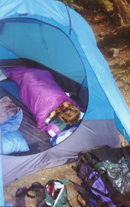
The spare bedroom in my home had been the repository for every possible item of hiking and camping gear since mid-April 1996.
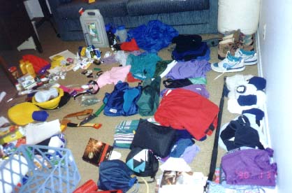
Repository for gear
I had originally planned to leave in the month of May for a trip through Utah and the Grand Canyon in Arizona, but was delayed due to a trial which went over through the month of May. As a result, summer holiday plans had to be changed and the month of July was set aside. My good friend, Larry Calloway from Santa Fe, New Mexico, agreed to hike in the San Juan Mountains in Colorado at the end of July. In June the idea of hiking the West Coast Trail in early July began to take shape. I had tried earlier to get reservations for this hike, but I was not aware that reservations had to be made in early March. Two days after the trail reservation office was open, the trail was fully booked for the summer of 1996. My only other option was to go to Port Renfrew or Bamfield and hope that I could get on the trail as a walk-on. This may mean some delay in beginning the hike while I waited around to get on the trail.
My brother, Tom came to Edmonton for a visit in early June and we discussed the possibility of this hike. I followed up with frantic calls during the month trying to set a time for the hike. Tom's calendar for July was already booked with a canoe trip for the students at his College in mid-July and he usually planned a canoe holiday with his girls, Christy and Jodi at the beginning of July. He was very reluctant to miss his holidays with his girls. But Jodi had a soccer tournament in early July. Terry Hannan encouraged Tom to go on the hike with me. Finally, a week before the trip was to begin, Tom acknowledged that he would come to the west coast to hike with me in early July.
THE TRIP BEGINS
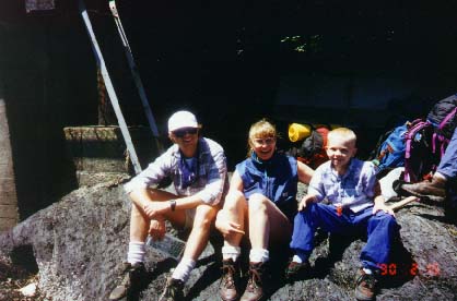
Tom decides that our trip should begin at 4 o'clock in the afternoon of 29th June 1996. He arrives at my home and indicates that before we leave, he wants to go shopping at Camper's Village. Big mistake!! Tom purchases a tent and a shopping cart full of other hiking goodies. But the most deadly purchase is an ultra wet gortex outfit. It would have been totally inappropriate for me to hike with such a well-dressed backpacker who would actually keep himself dry. I am forced into purchasing a gortex jacket for myself - $500.00. Peer pressure - big dent in the budget before even leaving Edmonton. We drop Tom's car at the Edmonton airport and drive through the night to Winfield, British Columbia arriving around 1 o'clock in the morning of 30 June 1996. Mom and Dad are still waiting up for us.

Tom with my parents
Tom is not content to sit around and visit our parents - he wants on the trail - so after several hours of sleep, we eat a large meal at noon on the 30th June 1996 (the last supper) and head for Vancouver - Tsawwassen to catch the ferry to Victoria. We hope to catch the last ferry, but arrive minutes before the 6 o'clock evening ferry is set to leave. We are delighted. We drive to Port Renfrew, arriving very late. Tom and I thrash around until well after midnight setting up camp. Apparently we make a lot of noise and our lantern wakes up hikers in the neighbouring tents. The next morning, as they are packing to leave on their hike, they make loud asides to one another about rude campers. Little did they know that we will be dogging them every step of the trail. Tom calls them "The Von Trapp Family". They consist of two sets of older parents, age 50, and a younger couple in their mid-twenties, and a young boy with knock-knees.
Monday, 1 July 1996
I awake early this morning to line up at the trailhead office for a walk-on pass. This hike is usually done by reservations, but 6 hikers from each end are permitted on the trail as walk-on hikers. We know that we may have to wait for two or three days to get our pass. When I arrive at the trailhead office at 7 o'clock in the morning, I find two brothers waiting ahead of me. The elder brother is the director of Red Cross for British Columbia (in his previous life he was a lawyer) and he had hiked the West Coast Trail. The younger brother is a movie director or producer and he is a neophyte like ourselves. Both are from Vancouver. While we wait, I try to organize and pack the food for the hike. I offer the brothers some of mom's chocolate raison cookies.
The young native woman who runs the office arrives early and tells us that we are the only hikers to arrive for that day. We are all going to get passes. Hooray!!!!!!! Tom arrives just before the office opens at 9 o'clock in the morning. and we all go in to watch a film and hear about the rigors of the trail.
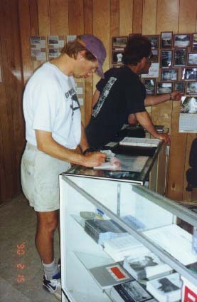
Tom at trailhead office
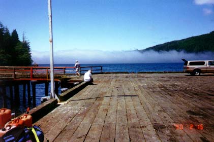
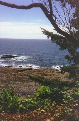
To access this trail, we are aware that we must take a boat across the Port San Juan sound. We determine, from local gossip and the guide books, that the boat departs from the Port Renfrew pier. There is a telephone at the end of the pier and Tom calls Terry to let her know that we were off. Tom tries to organize an exchange of vehicles with a friend who is beginning the hike from the opposite direction. We wait at a hut labeled "West Coast Trail" located at the end of the pier. As we wait, we gaze out to the sea. Port Renfrew is located on the south side of Port San Juan. To the east we see the cup of the sound - ringed by virgin forest; to the west - sea fog.
Sea Fog
We know that along the southwestern shoreline of Vancouver Island an old lifesaving trail was built after the turn of the century to aid shipwrecked mariners. In the 40 years prior to 1905, this stretch of shore had been the graveyard for over 50 vessels with a loss of over 700 lives. In January 1905, the worst Canadian maritime disaster occurred when the 'Valencia' - a passenger liner on route from San Francisco to Seattle and Victoria ran aground near Pachena Point. The story goes that the ship did not sink immediately, and 75 to 80 people (mostly women and children) were tied to the rigging, huddled under blankets, while the men tried to make it to shore. Less than a dozen made it to shore. They watched over the next 40 hours as the sea destroyed the 'Valencia' and those left on the ship fell into the water one by one. The lifesaving trail and the telegraph line located along the trail, were used by the survivors to find refuge. This trail eventually formed the backbone for the West Coast Trail.
So here we are standing on the pier looking out over the coastline and gazing into the fog - wondering about what we will meet on this trail. Al, the boatsman, arrives in an open metal scow divided into eight individual compartments.
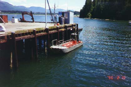
Boat
He advises us that we are to load into the boat off a rock located mid-pier. We see a number of backpackers, including two young boys resting on a rock under the pier.
Waiting on the rock
The thought that this family is traveling with young children eases our concerns about the rigorous of the trail. We greet the family and ply them with mom's chocolate raison cookies to get in their good books. You never know who you may need to give you a hand on the trail.
At one o'clock in the afternoon, we load into the boat and pay Al our ten dollars a head. We ease into the fog. From that point this hike takes on a nether-world perspective.
There are two points where the boat will off-loading hikers. The actual trailhead is on the Gordon River - the trail is 75 km. long from that point. A second option, available for the last time this year, is to off-load at Thrasher Cove - reducing the length of the trail by 5 km. The first 5 km are reputed to be unpleasant and we opt for Thrasher Cove.
Thrasher Cove
Off-loading at Thrasher Cove is not described in detail in the hiking guidebooks. Al only informs you of the process once you have paid the fare and arrive at the cove. He explains the process as follows: "The boat cannot approach the shore without damaging the propeller. Instead we will approach a large rock located in Thrasher Cove when waves are ebbing from the rock. Each hiker, with his pack, leaps from the boat onto a metal chain ladder attached to the rock and then scrambles up the rock and walks to the shore. The timing of the boat's approach to the rock is critical - a mistake in the timing and the boat will be smash against the rock by the wave."
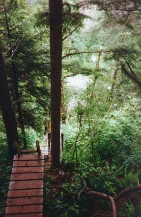
Surprisingly, we accomplish the disembarkment procedure easily. The trail is simple to find from the cove. Just look for the ladders and go up. After climbing three or four ladders we arrive at the trail itself. We have moved 100 meters from the sea and I am exhausted. We take a break.
Tom taking a break
This is not an auspicious beginning. From that point the trail routes its way through huge trees, over roots and across boggy areas. Crossing the boggy areas is especially exciting as this involves balancing over trees sawed in half and laid out over dips in the trail. These are not minor bridges - these are 30 to 40 foot trees sawed in half lengthwise. The bridges are about 2 feet wide and are often cross-scored to reduce the possibility of slipping on the wet wood during inclement weather. These bridges seem, at the time, to be but a few inches wide. Under the bridges, the growth is lush and wet. Huge ferns and leafy plants abound and all around us the giant trees block all sound. It is hard to believe that only a narrow strip of virgin forest remains clinging along the coast, preserved in the Pacific Rim National Park. Inland, loggers have clear-cut the timber.
My new boots, fresh from the box, are quite loose and are causing me no problems except for the need to keep gronching down the laces. I insist on another break within a few hours of hiking. Tom is in excellent condition and is keen to move on; I am a sedentary chain-smoker who requires oxygen breaks from time to time. We spent the next hours and days root hopping, tree walking, skirting pools of mud and climbing up and down steps built for giants through the huge old growth forest. After a time, the trail changes to boardwalks which provides considerable relief from the uneven terrain. With level footing we put on miles with little effort. However, the boardwalks present a less obvious danger. They are rotting in sections. An unlucky break in a board will result in a broken leg. While body and pack continue to move forward, your leg through the boardwalk will remain stationary. Long after the hike was over, this was the danger of the trail that caused me the greatest concern.
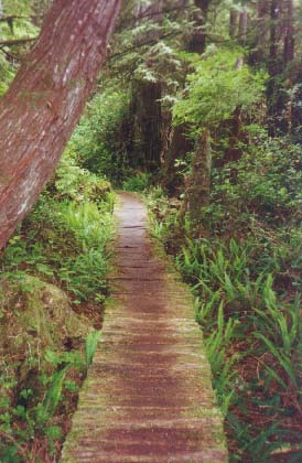
Rotting boardwalks
Before we arrive at the first night campsite at Camper's Creek, we hear the noise of the creek interrupting the quiet of the forest. We climb down 4 or 5 ladders to a cable car which crosses the creek. I want to walk across the creek, but Tom insists that we get our full money's worth and try the cable car. So we climb up a ladder to the cable car. I load into the car with the backpacks, but before Tom can climb in, my walking stick slips through a crack in the floor of the cable car and lands near the creek. Tom gallantly offers to climb down the ladder to retrieve my walking stick. But once he has negotiated the ladder for the second time, he decides that the walk across the creek looks easier than the climb back up to the cable car. I watch him walk with ease across the creek as I sit in the tiny cable car with the two packs. I have two choices. Climb out and carry the two bulky packs across the creek or test the flimsy contraption. I choose to pull myself across in the cable car. This means grabbing one of the two cables and bodily hauling the car and myself and packs along. A pair of leather gloves would have been helpful. Tom climbs up to help me off load.
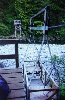
Cable car
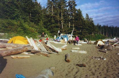
We hike down the trail to the ocean and set up camp at 8:00 o'clock in the evening. The campground is packed with many tents and people crowd around the fires. The only site left is in the trees under the bear pole. Everyone has hung their food up around us. If we had been hungry we would have been set. However, we see these caches of food as bait for the bears. We are concerned we will be the main course if a bear should stumble into camp this evening.
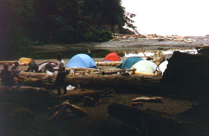
Camp on the ocean
Tonight we cook stew with 2 potatoes, 2 carrots, 1 small onion, garlic, canned chicken and a chicken gravy mix. With a little salt and pepper it was fabulous. We fall into the tent - exhausted.
Tuesday, 2 July 1996
We are up and organized to leave at around 8:30 in the morning and as we set out we see two joggers racing past the campsite down the beach. Both wear running shoes. The woman carries a small day pack and the man has a fanny pack. Where they came from - no one knows. Where they are going - we are equally puzzled. They became the topic of conversation at virtually every campsite for the rest of the hike. It turns out that they had been dropped off very early that day at Thrasher's Cove, they ran some 58 km to meet up with friends later that day at Michigan Creek located at the 12 km mark of the trail. I guess they didn't have a lot of holiday time.
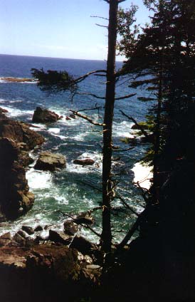
For the first time we are able to walk along the shore - on the rock shelf. The shelf along the coast is interrupted by surge channels - or fissures in the rock where waves rush to strike the rock head wall and then sucks everything from the fissure back into the sea. Warnings about the dangers of traversing surge channels are rampant in the literature and in the talk given by the ranger. A few hundred meters beyond Camper's Cove we come to the first surge channel. The force of the wave action is so strong at that fissure that it has carved a cave in the head wall. Fortunately the tide is low enough that there is no water in the surge channel when we cross. However, the channel itself is very slippery with green algae. Three fellows who had crossed that channel during high tide the previous day, follow us as we hike along the shelf. They carry rope to assist hikers across the channel.
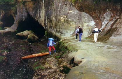
Roping across channel
Tom ties the rope around his middle and carefully walks across the channel. Tom then holds the rope taut on the far side of the channel and I cross using the rope to balance when the going is slippery. After we cross, we can see the men helping the two brothers we met the previous day. We wait for the brothers and the four of us walk along the shelf for about 2 km.
This is delightful hiking - we roam along the shelf looking at sea critters in the tide pools while the waves crash against the outer rock. I don't seem to be fully aware of the slipperiness of the rock until I find myself on my keister as we skirt a surge channel. I have slipped on green algae, ripping my pants and leaving my right knee wet with blood. I patch myself up but this injury will take a long time to heal.
The rock shelf ends abruptly at Sandstone Creek. In fact the abrupt ending only occurs because the tide had come in and we are essentially rimmed out. We off load our packs and Tom finds the way down. The only way off the shelf is a tricky move wedging yourself between the ledge and a huge boulder and easing yourself down into the ocean. The drop is about 10 feet from the ledge to the water, but fortunately someone has wedged a board 4 feet from the top and one can place a foot on the board, slither down to rest your bottom on the board and then leap down to the water. The key is timing the leap to coincide with the wave leaving shore and land in a few inches of water thus keeping your boots dry. If your timing is off you will land in a foot and a half of water when the waves are breaking on shore. We rope the packs over the ledge to Tom and each of us follow his tricky maneuver to the shore. The elation of landing safely is soon dispelled as we struggle to make our way through the slippery rocks to a relatively safe spot above the waterline. The exhilaration of the safe escape is followed by lunch of bagels and cream cheese. Dessert is mom's ginger snaps.
Because there is an impassable headland beyond, we hike up Sandstone Creek to the inland trail. What follows is the horror of ladders, many ladders, BIG TIME LADDERS.
Ladders
By Cullite Creek I want to stop. I am wasted. My right knee hurts from the fall and my left hip is blown by climbing up and down ladders. I know I will never make it up the ladders on the north side of Cullite Creek. I gratefully accept Tom's assistance when he offers to climb up the ladders with his pack and then climb down to carry my pack up the ladders. I could never have made it otherwise. We hike along inland crossing a suspension bridge that freaks out Tom at Logan Creek. He's not wild about heights and he insists that he crosses first while I wait at the end of the bridge so that it will not sway. I then cross with no difficulty.
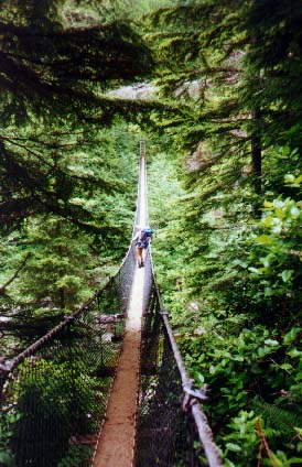
Suspension Bridge
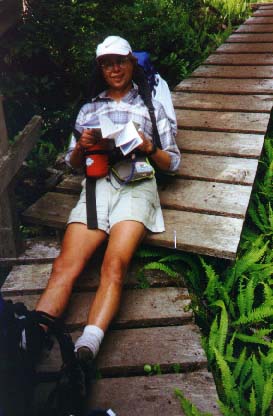
Shortly after, we hunker down in a rain storm near Adrenaline Creek. I smoke - Tom wants to move on. I try out my new gortex jacket and find it worked very well - but is warm for hiking. The rest of the hike that day is mud, roots and incredible bogs large enough to lose a troop of boy scouts. Sometimes we try to skirt the bogs and pick our way through trees. Going around one bog, I have to climb through the crotch of a tree about a meter off the ground. My hip and knee are so sore that I have to use my arms to lift up my leg and insert my foot in the crotch of the tree and then I pull myself up with my arms in order to pass through the tree. My rubbery legs are too weak to support my own weight. At other times, we come to a huge bog and find we can actually walk through the middle of the bog - almost on water - because just below the surface of the water and invisible are stumps of trees forming a foot path through the bog. Sometimes these foot paths run out half way through the bog and we find ourselves in mud up to mid-calf. The gaiters I bought just before the hike prove very useful during this part of the hike. The mud at times is so thick that it actually sucked a running shoe off a hiker. We find the shoe - but no hiker.
All along the trail we see enormous slugs. Some are white, some are green and others are yellow - one hiker called these 'banana slugs'. I take a picture of one beside my binocular case. I should put a miniature doll chair beside the slug when I take the picture and then I can tell the story of enormous creatures that chased us on the hike.
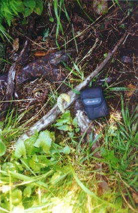
Slugs
This part of the hike seems endless. At one point Tom guesses that we have just crossed Adrenaline Creek. I shout "no!". I want this misery to end. We need to be at least two km. further along the trail. The gods are listening. Just around the corner we find Walbran Creek. But just to make the end of the day exciting we find that the top ladder down to the creek is flagged with red survey tape. It is rotted, old, shaky and unusable. The end of the day's hike is at the bottom of the creek - some 4 or 5 ladders below. To the left of the top ladder we find a rope tied onto a root about a meter down the cliff. The trick is to inch backwards down the cliff on your belly until you reach the rope. Then lower yourself, hand over hand, down the cliff. I am vibrating with fear while lowering myself down the rope. The relief at making my way down the rope is soon eclipsed by more ladders. Suddenly, we are at Walbran Creek. We crawl down a path, under deadfall, to the beach. Tom locates a great campsite on the beach near driftwood logs and he sets up the tent and gathers firewood and lights a fire (men's work) while I wash the mud from my gaiters, make a scotch and wrap potatoes and onions in foil and place them in the driftwood fire (women's work). Then some hot chocolate for Tom as we sit around the fire. Tom puts his boots on a stick over the campfire to dry. Eventually the fire is ringed with sticks holding gaiters, socks and boots.
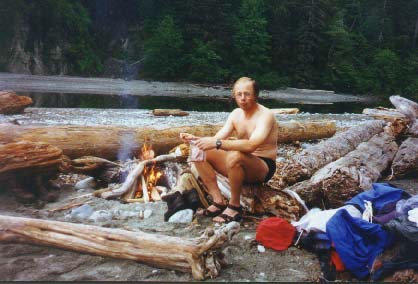
Tom by campfire
Suddenly someone yells "Whales!!!!!". All the hikers rush to the shore. There we see a pod of whales slowly moving along in the ocean - occasionally plumbs of water rise from the sea and the back of the whale lifts out of the water and a tail rises in the air and then they are gone, moving down the coast to better hunting grounds.
My back hurts, my legs hurt, my arms are sore. I can hardly want for more fun. I share my scotch and the last of mom's famous chocolate raison cookies and ginger snaps with the brothers at 10:30 that evening and then someone from the Von Trapp family yells "pipe down - it's late". We go to bed muttering about the rudeness of others.
Wednesday, 3 July 1996
I discover that Tom likes to sleep in. I am up at 6:30 in the morning. It had been misty and raining and our packs are wet. We stored them under the fly the night before but left the fly open during the night. The sea fog and mist has left everything damp. I make breakfast and coffee and watch Tom sleeping in his bag. Finally I serve him breakfast in bed - I discover this is the only way to get him out of the tent in the morning.
Tom in morning
We leave relatively early to catch the tide. We consider wearing our Tevas to ford Walbran Creek but we see one of the "Von Trapp" family members is walking along the shore towards the creek carrying a log. At first I think he is trying to caber-toss the log. But as we get closer we realize he is building a bridge. As the log goes down, we step on the far end and cross the creek on the log before he even has a chance to test it. We thank him and stroll down the shore, laughing at our inventiveness.
Along the coast
The weather is overcast one moment, brilliantly sunny and hot the next and then raining at other times. This results in considerable changing of clothing and packing and unpacking. Walking along the coast sure beats hiking in the mud and roots. But the sand is a killer on leg muscles. My boots and socks remain wet from yesterday's hike. I must be sure to dry them out tonight.
As we are hiking along the coast we come across flotsam and jetsam which has washed to the shore. At one point we come across a hockey glove that washed to shore from a Russian tanker. I remember reading about these items washing off a huge tanker in the Pacific and floating onto shore all along the west coast of North America. At another point we come across a brand new running shoe with the laces still wrapped inside the shoe - just the way you would find new shoes when you remove them from the box.
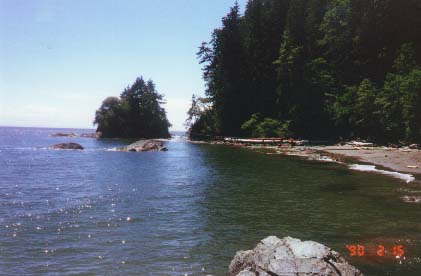
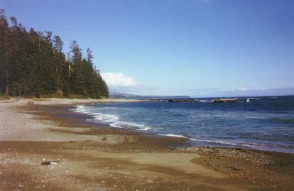
We pass Vancouver Point in short order and before we know it we are at Bonita Point. We pass a group of 9 school kids between ages 14 to 16 who are hiking in the other direction. Lunch time at Bonita Point - we settle into an overhang located under a seastack. I remove my boots to let my feet breath. After lunch we round the corner of Bonita Point and Carmanah Beach fans out for 3 km ahead of us - the waves alternatively crashing or lapping on the beach as if the sea seemed undecided whether to be gentle or powerful. Looking back we see tendrils of sea fog rolling in over Bonita Point. We hear the fog horn from the lighthouse ahead - Carmanah Point. Along the beach I count 15 hikers going in the one direction or the other. As we hike along, we wander now closer, now farther, from the sea. The history of our indecision is written in the sand - our footprints trail us like drunken sailors. We pass a party of hikers which includes our ranger from the Port Renfrew trailhead. Amongst her party of hikers is an old woman who walked along slowly but with great dignity. We are amazed that someone her age would attempt this hike. We pass Carmanah Creek - several tents are set up - this river leads through the forest to the largest tree in Canada - the Carmanah Giant. But it is some distance away and the hike to the tree from the sea is long and not recommended. [
Past Carmanah Creek we rest on a driftwood log and looking through the mist we can see land. Tom calls these stops "Kodak moments". He tells me that he wishes he smoked - I seem to be enjoying the cigarette so much. Tom tells me his leg muscles are jumping - hiking through the sand seems to adversely effect him. I love it. I love the long views. I try to convince Tom that the land we can see looking west must be Japan. We pull out the map and discover that we are looking at the Washington Peninsula.
Coast
We also discover that we are on Indian land - Indian Reservation 6. This explains the semi-permanent camp set up where the trail turns inland to cross over the impassable headland at Carmanah Point. As we hike along the beach we pass a man with long dark hair, a young boy and a black dog standing in front of one of these shacks. I ask the man whether he appreciates all these hikers passing through his front yard. He tells me he likes them - he runs a store. He sells beer, hot dogs and chocolate bars - but he only has chocolate bars left.
We climb back up ladders from the sea to the heights of Carmanah Point. Along the climb we are passed by the Von Trapp family as they surge ahead of us. They turn the trail towards Carmanah Lighthouse - but we are anxious to get away from this unhappy group and we continue over the point and find a small trail leading down to the sea. We have found a small cove just beyond Carmanah Point.
Cove above Carmanah
Without any words, Tom and I remove our packs and our socks and shoes and walk into the sea. It's cold. I stand there in the sea looking out and see a huge rock which appears to be writhing and moving through the mist. I return to my pack and with the help of binoculars, the rock becomes a mass of sea lions - from time to time one falls into the sea and then with some Herculean effort they leap from the sea and pull their huge mass back onto the rock. Some of the sea lions appear to be much larger than the others. I remember hearing about large numbers of these animals dying off the coast of California for inexplicable reasons - it turned out that some of these creatures, being two or three times larger than others, have crushed the smaller ones with their weight, in their amorous moves. That was the biologist's explanation for the deaths.
The sun is hot, the waves lap repetitively on the shore and the rest of the world is far away - we both fall asleep on the beach and awake only when the sun's heat dims. The Von Trapp family passes us - commenting on our laziness. Towards late afternoon we gather together our equipment and have an easy hike to our next campsite at Cribbs Creek.
Cribbs Creek Campsite
At Cribbs Creek we arrive later than most campers and set up our tent some distance down the beach. The creek is named for a headland of rock along the beach which acts as a breakwall for the sea. When the tide is in - waves crash against the rockwall. The rockwall or crib acts as a promenade and hikers walk along the wall gazing to the sea. Supper consisted of Knorr's vegetable soup and spiral pasta - very tasty. I celebrated the day with a tin of smoked oysters and crackers. Tom lit the campfire. There is a frog croaking in a pond nearby. Someone will have to put either it, or us, out of our misery. I decide that I must name my boots - they have stood up beautifully - not a single blister. Tom suggests Nit and Nat. They are so christened. (We will cross Nitinat Narrows tomorrow). At the rate that we are traveling we may finish the hike in 6 days rather than the 8 we had planned.
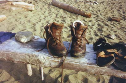
Nit and Nat
Tom is belly aching about the weight of the Kraft cheese dinners that he is carrying. One of the things I discover on the hike is how Tom and I differ on food choices. He likes food which is light to carry. I like anything I can stuff in his pack. The heavier the better. One food we totally disagree on is my oat bran sesame sticks. He calls them cat food. I gobble them up - two pounds of beasties found their way into my craw over the course of the hike. One thing we did agree on was mom's cookies. They made us many friends all along the trail. Many hikers came to appreciate the offer "one of mom's cookies?". Tom must have been carrying at least four pounds of mom's cookies at the start of the hike. By now they are all gone.
Thursday, 4 July 1996
Early in the morning it rains and at sunrise the air is damp and cool. There is no pleasure in getting out of the sleeping bag before the sun begins to dry out the sand, tent and logs, so I lay bundled up warm in my sleeping bag until 8:30. We eat and pack leisurely letting our tent and gear dry before leaving Cribbs Creek at 10 o'clock. We have been warned that there is no easy water available between Cribs and the Narrows so our packs are heavier.
The trail is easy - mostly on boardwalks through the forest. We beach walk along Dare Beach. This would have been one of the most beautiful campsites but the area is closed to tenters as two bears have been seen in the area. Ancient sand dunes located inland from the campsite look fascinating but notices indicate that hikers should tread carefully in the area to preserve the remnant dunes. The hike moves inland through a number of small Indian Reserves. In the reserves the trails turn into miniature roads - root free, smooth and wide. Neatly pruned hedges tower over our heads and line both sides of the path. Here and there we pass rows of raspberry canes along the path - the occasional raspberry still clinging to the prickly canes. I taste one and the sweet juicy raspberry taste remains in my mouth for a long time. Signs request that hikers remain on the trail and not wander through the villages. I see a few shacks but hear no people - it is difficult to believe anyone inhabits this area. The only hint that others live nearby is the occasional dog we pass on the trail. Dogs are not permitted on this hike.
Tom hikes on ahead while I dawdle along. I arrive suddenly at Nitinat Narrows. It is 3 o'clock in the afternoon and I find a number of hikers sitting on a bench. Tom is laying on the dock. I lay my pack down and sit to rest, waiting for the boat to leave. Carl and his famous dog sit in the boat and exchange gossip with the hikers.
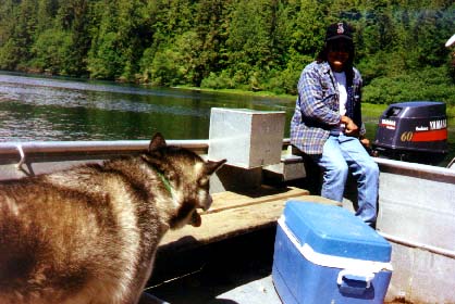
Carl and his dog
Tom tells me that there is a canteen on the float off the end of the dock - with beer, pop, hot dogs, hamburgers and chocolate bars. Heaven!!!! I ordered a beer. The young girl working in the canteen is an Ermineskin girl who came west to visit her father's family and decided to remain. The land along the Narrows is beautiful - wet and warm. When the tide is high the salty ocean water flows inland up the Narrows and when the tide is low, Nitinat Lake's fresh water flows out to the sea. Trees overhang the narrows on both sides of the channel - I think of Louisiana - so lush is the vegetation. The other hikers rise and leave the dock traveling the direction we just came. I thought they were waiting for the boat to leave, but they had just crossed and were taking a beer break before continuing their hike. Tom and I alone load into the boat with Carl and his dog, pay our five bucks each, and he motors us across the narrows. The ride takes no more than ten minutes.
From the Narrows to Tsusiat the trail seems rough and tiring - up and down over roots. This is a major change from the smooth trail we have just crossed on the Indian Reserves. We beach walk along the coast between Tsuqadra Point and Tsusiat, but are unable to walk to the hole in the rock at Tsuqadra Point because the tide is in. Just before coming to Tsusiat Point we make the mistake of returning to the trail and hiking uphill for some distance. It becomes immediately obvious that this is a wrong. The campsite is on the beach and we are hiking uphill to cross Tsusiat creek above the falls. Tom had suggested that we continue along the beach, but I was tired and suggested that we stay on the trail. My mistake.
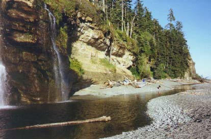
Above the falls, we see the beach below and we climb down ladders to get to the camping spot. The campsite is fabulous. The creek flows over Tsusiat Falls and crashes on the beach below, forming a huge pool which eventually flows into the sea. The crossing of this pool is a major undertaking. A large log about 60 ft long lies across the pool and Tom, who has hiked ahead, appears to have crossed it with ease.
Pool with log in distance
I take one look at it and decide to walk to the ocean and remove my boots and cross the freshwater stream. I am able to find an alternate method using a much smaller log and rock-hopping and then I follow Tom along the beach to the north end of Tsusiat Beach. Tom chooses a spot far away from other hikers hoping that we can continue to beach walk north the next morning. He doesn't realize that Tsusiat Point, at the end of the beach, is another impassable headland. Tom builds another fire on the beach in a protected area surrounded by driftwood and we sit and talk about very silly stuff until late into the evening.
Friday, 5 July 1996
I awake early and it seems like it will be a fine day, though the sun had not yet touched the beach. I make coffee as a gorgeous day dawns. We can see campers packing up and moved off but we linger at the site soaking in the beauty.
Tsusiat Falls
Eventually both Tom and I shower under the Tsusiat Falls - which leads to our only major conflict during the hike. Tom wants his picture taken while he is under the falls, but he refuses to remain there for any length of time. I want to take a properly focused picture and fiddle with the camera to set the F-stop and focus it properly, and waste a lot of time. Tom meanwhile ducks under the falls and roars out demanding to know if I have taken the picture. Finally he just gives up. I never did get a picture of him actually under the falls. I must have blinked when it actually happened.
We visit with the two brothers whom we met the first day of the hike. We had not seen them arrive at Tsusiat beach the previous evening. They told us they arrived very late because they had waited at Tsuquadra Point for the tide to go out so they could take pictures of the hole in the rock as the sun set last night.
The hike out from Tsusiat Beach is very exciting. We leave at about 1:30 in the afternoon. I had watched the Von Trapp family cross the huge log earlier in the morning. One after another, like little robots, they walked across the bridge - even the little knock-kneed kid crossed. I am determined that if they could do it then so could I. I watch Tom cross easily. He waits on the other side. I dither and dally, first tightening straps, then loosening straps, and finally I begin to walk across - only to turn around mid-log and scuttle back. It occurs to me that turning on the log is more difficult that simply crossing it. I gather up my courage, put my head down and cross. Fear does strange things to us - the log is wide and stable and I cross it easily. But I still let out a yell of relief once I am over. I am ecstatic. I actually have overcome my fear and done the task that had nagged at me all morning. I ask Tom how long the log is and he tells me it is 600 ft. I believe him and write that number in my journal. I now think he was getting back at me for the shower incident earlier that morning. Sometime later he tells me the log is only 60 ft long. How was I to know - I'm not much good at comprehending distances.
The hike that day is easy - once we climb back up the ladders to the trail. We have a little excitement at the Klanawa River crossing where we come across another cable car. This time there is no possibility of hiking over the river - it is large and deep. We climb up the ladders to the cable car and both load in. Tom is hanging onto the cable as we load in but as he sits down, he lets go of the cable. The cable car began hurdling down to the river. Forget about pulling yourself across. I was afraid that we wouldn't be able to break before hitting the other side. We screamed: "HOLY CROW" (or words to that effect). We obviously startled some German hikers who were on the other side of the river. They climb up the ladder to the cable car to see what the fuss was all about. This makes off loading ourselves and our packs somewhat precarious with four of us standing on a little platform two feet by four feet wide with rickety railings.
From Klanawa River we walk along the beach for most of the day to Darling Creek. There is a lovely falls and pool at Tsocowis Creek. On a hot day, that creek would make a great swimming hole. We cross Orange Juice Creek on the beach and see only one hiker during the last stretch - an female Indian park ranger.
At one point during the day we see a rescue helicopter heading south along the coast and I imagine a downed hiker and the difficulties of getting out of some of the spots along the trail. We see a orange survey tape at another point on the trail, marked with a notation that made it clear that there had been a search conducted in that area. While it is reassuring to know that help could be had, the dangers of the trail are evident in the livid colours of the survey tape and the words "Rescue" on the side of the helicopter. We pass old telegraph poles along the trail, reminding us of the original purpose of the trail.
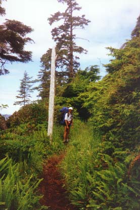
Telegraph poles
We arrive at the Darling River late in the evening and have little time before dark to cook our macaroni and cheese for dinner. Tom insists that we use both cheese packages to lighten his load. A troupe of boy scouts from St. Albert are camped near us. As we sit eating our dinner, and we watch a pod of whales move slowly along the coast - Tom tells me that he's getting anxious to end the hike - he is missing his girls.
Tom hits the sack and I sit writing my thoughts on the last night of the hike:
1. Though beach walking is hard on feet and calf muscles - I prefer it because one can see where you are going and you can kill those bubbly kelp with your walking stick and they make an incredibly satisfying pop.
2. Shelf-hiking is best but you need waterproof boots and must be careful of the slippery green stuff.
3. Spend a hot day at Tsusiat Falls or Tsocowis Creek which has falls and a number of small pools. Beautiful.
4. Take at least 6 or 7 days to do the hike.
5. Consider the benefit of beginning the hike from the Bamfield end - then you work up to the hard ladders and won't blow out pelvis-leg-knee connections.
6. Binoculars are a plus for whale watching.
7. Take gaiters - a necessity not a luxury on this hike.
8. Pepperoni is wonderful.
9. Take a spoon (I left mine behind) and Knorr's soup - it's great.
10. Don't drink a beer at the Narrows - it's too hard to get going again (just kidding).
11. A person alone can easily do Nitinat Narrows to Bamfield but the surge channels north need help or special caution. Tide is not a major factor on beach walks - just on shelf walks.
12. Go through the hole in the rock at Tsuquadra Point. It looks interesting.
13. Consider taking a synthetic bag instead of down - much more rain and I would have been clammy at night.
14. Consider taking warm booties for night. Tevas are ok but sand is very cool once the sun goes down.
15. Remember a bandanna - I forgot one but found one left behind at the first campsite.
Saturday, 6 July 1996
I'm up early again. Tom is still sleeping as is everyone else at Darling River. It's cool so I make some Ichiban soup for breakfast and I eat most of it. Tom gets out of bed. He is always a sight to behold first thing in the morning. He does a little morning dance on the beach.
We begin hiking out along a shelf on the coast, passing Michigan Creek (another popular camping spot). Then we head inland again on the trail climbing up to Pachena Point and Pachena Lighthouse. It's hot on the trail away from the water - I can feel my feet roasting in my boots. Tom goes on ahead to see the lighthouse grounds. I arrive later and register in the trail hiking book. I see Tom's name ahead of mine - so under remarks I note that I had to carry Tom's pack over the West Coast Trail. That will teach him not to leave me to my own devices! I hope his friends read that comment. Pachena Lighthouse is probably the last remaining wooden lighthouse on the Canadian west coast.
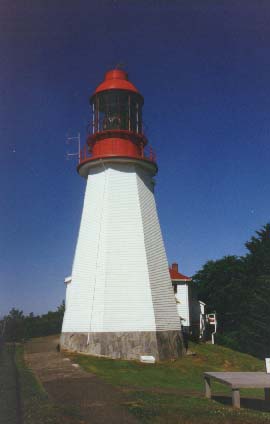
Lighthouse
It and the surrounding buildings and home of the lighthouse keeper are exceptionally maintained and are freshly painted in the traditional red and white colors. We rest on picnic tables at the lighthouse. Then we begin the long 10 km hike to the trailhead at Bamfield.
As we are hiking we hear 'flop, flop, flop' ahead of us on the trail. We come across a fellow resting on a rock beside the trail. He is smoking a cigarette. I comment that he is a man after my own heart. He offers me a cigarette - we chat and he tells me he had to stop his hike today. He was German and he had booked his hike months ago from Germany. He and his Canadian cousin and a friend had hiked to Michigan Creek from Bamfield yesterday. Just before they arrived at Michigan Creek he blew his hiking boots when he slipped on the green algae along the rock shelf. He lost one of the vibram soles to his shoe and the other sole remained hanging on his boot by only the heel. He and his hiking friends spent the evening debating whether he could proceed on the hike using his runners. They decided against that plan because they heard of the dangerous footing later in the trail. So he is heading back to Bamfield while his friends carry on with the hike. He tied the flopping toe of his shoe with a shoe lace. While he was walking, the heel came off. So he is hiking back down the trail, his remaining heel flopping with each dejected step.
Tom hikes on ahead and I stop for a major rest about 1 km from the end of the trail. I never want these hikes to end. I can hear people laughing and splashing in the water at the Pachena Bay campsite.
It was a good hike - we were very lucky. The timing, the weather, the company - everything was great.
At the end of the trail, we rest on a round bench under a huge tree at the Bamfield Trailhead Office. While we are waiting for the bus back to Port Renfrew, we meet a gentleman who had just completed the hike. He calls the hike a "grunt". We ask what that meant. He says that "if the government made you do it, Amnesty International would start a "write in" campaign".
A Footnote on the Von Trapp Family: They were camped some distance from us at the Darling River and I last saw them near the Pachena Lighthouse. We were ahead of them on the trail and I kept expecting them to overtake me as I hiked out. They were exceptionally competitive and we became their chief competition. While we waited for the bus, I kept hoping that they would not show up as we didn't have tickets to get on the bus. When the driver arrived, he told us that he had a few empty seats but that he was expecting another party. I just knew it would be the Von Trapp Family and that they would get the last laugh by bumping us from the bus. But they didn't show and Tom and I joyfully took their bus seats into Bamfield, where we ate a huge hamburger and drank a beer. On the long three hour bus ride back to Port Renfrew, Tom and I exchanged tall hiking tales about the Von Trapp Family with a friendly family from Edmonton.